Mt. Kanlaon Volcano
Canlaon City – Negros Oriental
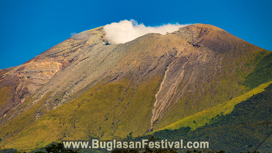
The majestic Mount Kanlaon rises on the border of Negros Occidental and Negros Oriental. This is the highest mountain of the Negros as well as of the entire Visayas. It is the largest active Philippine volcano, and its activity is monitored often.
It is 2,465 m high at its peak, although some sources mention the height to be 2,435 m. Its base measures 30 km in diameter and extinct volcanic craters and pyroclastic cones dot its north-northwest region. The Lugud crater, which is active, is just north of and below the summit. There is a small caldera, known as the Margaja Valley, to the north of Lugud. In some seasons, such as the monsoon, it becomes a crater lake.
There are 3 hot springs on the volcano’s slopes:
- Bungol Hot Spring
- Bucalan Hot Spring
- Mambukal Hot Springs – It lies to the northwest of the volcano.
Mount Mandalagan (to Kanlaon’s north) and Mount Silay are the neighboring edifices of the volcano. On the volcano’s lower slope, on the Negros Oriental side, there is the city of Canlaon.
Mt. Kanlaon – A Short History
Mt. Kanlaon gets its name from Kan-Laon, the God of the ancient Visayan community who is known as the Ruler of Time or the Supreme Ruler. He was worshipped in the pre-Spanish time by the locals. The mountain attracts serious hikers and mountain climbers from across the globe. Prior to climbing this volcano, tourists have to get a permit from the Canlaon Tourism Office. The climb has to be planned beforehand with the necessary paperwork, which has to be submitted to the tourism office at least a month in advance.
Hiking Trails and Destination
This volcano is the heart of the Mount Kanlaon Natural Park, which is a national park that was founded originally on 8th August, 1934. It is loved by mountain climbers.
Typically, the hiking trails begin from the Guintubdan village middle. The locals in this place have been actively involved with a number of European institutions in a spirit of international cooperation and for the introduction of the Unified Hiking Marker System as the first ever inland tourist spot in the Philippines. This is an integrated system across many countries. Thus, the mountain is an eco-friendlier and more attractive spot for tourists.
Hiking & Trails Markers System
The 1st 3 hiking trails were marked in the year 2016. In 2017, there was an addition of more extensive trails from the Guintubdan village’s middle, which includes a trail leading to the top. The Mendel University implemented these, along with the DENR and De La Salle University Bacolod. The Embassy of the Czech Republic, Manila, funded this project within the Czech Aid Development program framework.
In 2016 and 2017, 3 trails color-code with the colors of the flag of Philippines were opened. These included:
- Red Trail – It leads to Buslugan Falls from Guintubdan, and was marked in 2016.
- Yellow Trail – It goes to Oro Falls from Guintubdan, and was marked in 2016.
- Blue Trail – It directs to Salas Park new Pavillion from Guintubdan, and was marked in 2016.
- Red Trail – It goes to Mt. Kanla-On Summit from Guintubdan, and was marked in 2017.
- Adventure Trail and more new trails – These were marked in 2017.


Leave a Reply
Want to join the discussion?Feel free to contribute!